
FEMA: Letter of Map Revision (LOMR)
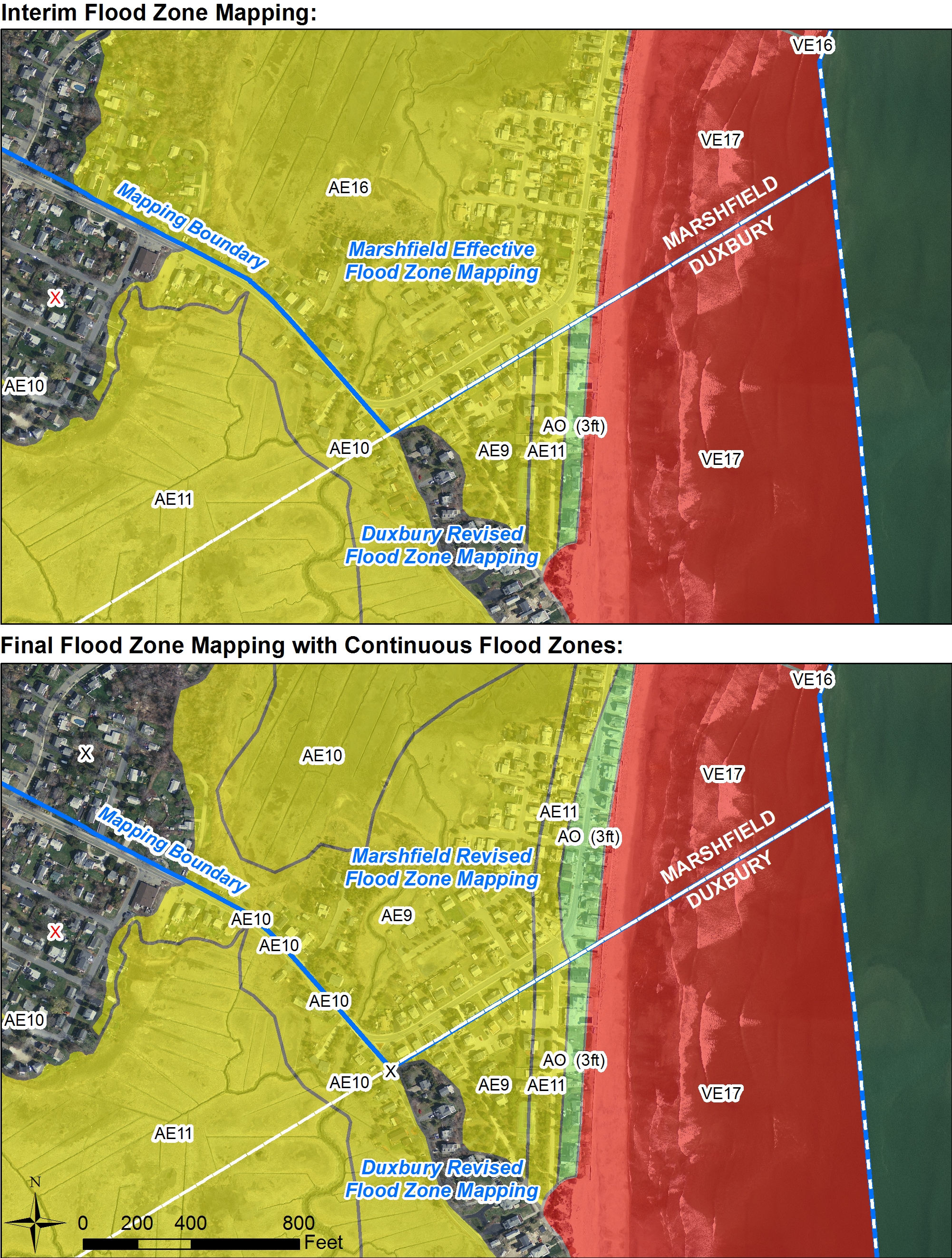
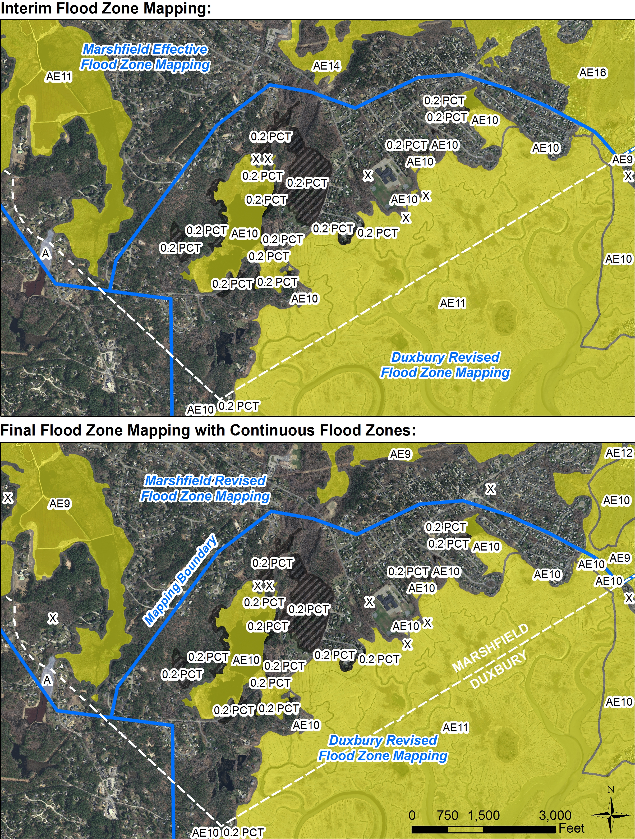
Duxbury and Marshfield have appealed the 2016 coastal flood maps with respect to wave setup, wave height, wave runup and overtopping.
Two different processes are being followed by the communities due to the number of Flood Risk Panels affected in each community. Duxbury's changes include 6 panels, while Marshfield involves 14 panels; Duxbury was granted an exception to the 5-panel limit for a Letter of Map Revision (LOMR), allowing it to revise the maps without adopting a new work map product. Marshfield will be going through a Physical Map Revision (PMR) process, which will take a little longer, due to the size of area affected. Duxbury's LOMR will not require new maps be adopted at Town Meeting; however, a public review of the upcoming changes begins August 14th for Duxbury. As a result of the revision, the 1% annual chance water-surface elevations shall increase, and decrease, and the 1% annual chance flooplain shall widen and narrow, within the area of revision in both towns. The LOMR will extend into Marshfield via temporary tie-ins while Marshfield's amendment process is undertaken, after Duxbury's LOMR is adopted.
Please submit comment to Valerie Massard, Planning Director, 878 Tremont Street, Duxbury, MA 02332 massard@town.duxbury.ma.us. Shapefiles can be shared upon request; however, the visually annotated files below are graphically the best representation of the proposed changes.
The following panels are affected - hot links to the annoted proposed changes as pdfs, and the temporary tie-ins, are available below: